Did you know parts of Toronto rise nearly 200 meters above Lake Ontario, while others sit just steps from the water’s edge? In 2025, understanding toronto elevation is more important than ever, whether you’re planning a home, navigating the city, or just curious about its hills and valleys.
This essential guide unpacks the basics, explores neighborhood high and low points, reveals how elevation shapes city life, introduces tools for measuring it, and peeks into future trends. Ready for expert insights? Dive in to discover why elevation is key for every Torontonian.
Understanding Toronto’s Elevation: The Basics
Ever wondered why some Toronto neighborhoods feel breezy while others seem sheltered and warm? Or why certain streets slope dramatically while others are flat as a pancake? The answer often comes down to toronto elevation. Let’s break down what elevation means for the city, why it matters, and how it shapes everything from weather to urban design.
Defining Elevation and Its Importance
Elevation is simply how high a point is above sea level, measured in meters or feet. For a city like Toronto, knowing its elevation gives you insight into everything from climate to construction. Toronto elevation averages about 76 meters (250 feet) above sea level, but that’s just the starting point.
Why does this matter? Elevation affects how cities grow, how water drains, and even how roads and buildings are designed. Low-lying areas near Lake Ontario are more prone to flooding, while higher spots offer scenic views and safer ground. To see for yourself, check out the City of Toronto Maps for interactive elevation layers and neighborhood profiles.
Curious how Toronto stacks up against other Canadian cities? Here’s a quick comparison:
| City | Average Elevation (m) | Key Features |
|---|---|---|
| Toronto | 76 | Lake Ontario, valleys |
| Vancouver | 70 | Coastal, mountains |
| Montreal | 31 | Island, riverfront |
| Calgary | 1,045 | Foothills, prairies |
The presence of Lake Ontario keeps toronto elevation relatively stable in the core, but venture north or east, and you’ll notice the ground starts to climb.
Geological History and Terrain
Toronto’s landscape is a patchwork quilt stitched together by ancient glaciers and shifting shorelines. Thousands of years ago, glaciers carved out deep valleys and left behind high ridges. The old shoreline of Lake Iroquois, now far above today’s lake, created a noticeable step in the city’s topography.
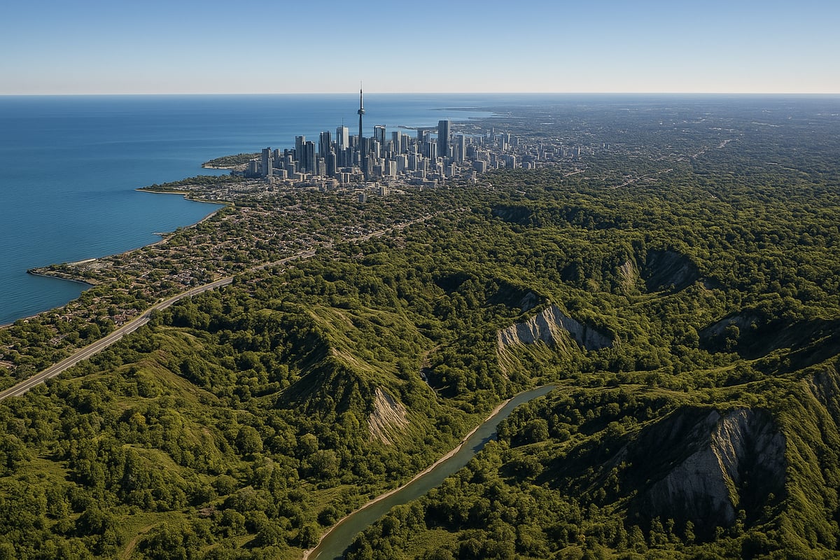
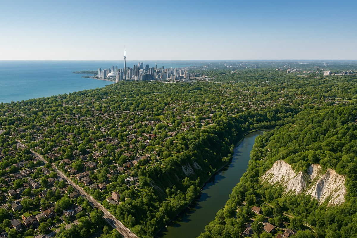
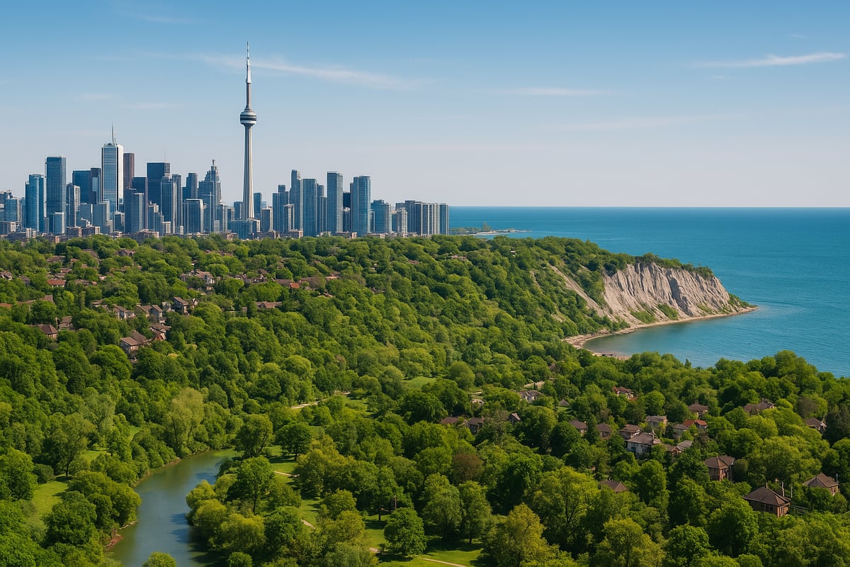
One of the most striking features? The Scarborough Bluffs. These dramatic cliffs rise up to 90 meters above the lake, making them one of the highest natural points in the city. If you’ve ever hiked the area, you know how quickly the toronto elevation can change from the beach to the top of the bluffs.
River valleys also play a big role. The Don, Humber, and Rouge rivers snake through Toronto, cutting deep channels and creating pockets of low elevation. In some neighborhoods, you can walk a few blocks and experience a drop or rise of 20 meters or more. This ever-changing terrain is a constant reminder of the city’s glacial past and the ongoing impact on urban life.
Elevation and Climate
Did you know that toronto elevation can influence the weather in your neighborhood? Higher areas tend to be a bit cooler and windier, while lower spots closer to Lake Ontario can feel milder, especially in winter. Elevation changes also help create microclimates, which means you might see snow linger longer uptown, while downtown thaws quickly.
Weather patterns and precipitation are shaped by these elevation shifts. According to Environment Canada, low-lying zones near the lake face a higher risk of fog and flooding after heavy rain. Meanwhile, elevated neighborhoods like Forest Hill or Yonge–Eglinton enjoy less flood risk but might catch more wind and occasional chill.
If you’re planning outdoor activities or considering a move, understanding toronto elevation can help you anticipate everything from snow accumulation to air quality. It’s a subtle factor, but one that touches nearly every aspect of daily life in this dynamic city.
Elevation by Toronto Neighborhoods: A Detailed Breakdown
Toronto’s landscape is a fascinating patchwork of hills, valleys, and lakefront stretches. If you’ve ever wondered how toronto elevation shapes the character of different neighborhoods, you’re not alone. Let’s take a journey across the city, uncovering how the highs and lows of Toronto’s terrain impact everything from city planning to your daily commute.
Downtown and Waterfront Areas
The heart of Toronto beats at the downtown core, where toronto elevation averages between 75 and 85 meters above sea level. These neighborhoods are nestled closest to Lake Ontario, making them the city’s lowest points. Stroll along Queens Quay and you’re almost at lake level, which brings both charm and challenges.
Flooding is a real concern here, especially during spring thaws or heavy rain. Recent development along the waterfront has focused on flood mitigation, with raised walkways and new drainage systems designed to handle sudden surges. For example, the revitalization around Queens Quay includes innovative landscape design to protect against lake overflow.
Here’s a quick comparison of average elevation in key downtown spots:
| Neighborhood | Average Elevation (m) |
|---|---|
| Queens Quay | 75 |
| Financial District | 80 |
| St. Lawrence Market | 78 |
Because of its low toronto elevation, the downtown area is also highly regulated for new construction, with developers required to meet strict flood-proofing standards.
Midtown and Uptown
Travel north from downtown and you’ll notice a steady climb. Midtown—especially Yonge–Eglinton and Forest Hill—sits at some of the highest toronto elevation points in the city, ranging from 130 to 150 meters. This rise isn’t just good for your step count; it also means better views and, often, higher real estate values.
Ever wonder why homes in Forest Hill or along Avenue Road command such high prices? Elevation is part of the answer. These neighborhoods offer sweeping vistas of the city and a sense of separation from the hustle and bustle below. Of course, the hills can also make for more challenging winter driving and trickier access for transit and pedestrians.
For those who love the outdoors, higher toronto elevation means more parks with rolling terrain and trails that offer a real workout. If you’re planning a move or a run in Midtown, don’t forget to check the slope of your street!
East End and Scarborough
Head east and you’ll encounter some of Toronto’s most dramatic natural features. The Scarborough Bluffs soar up to 90 meters above Lake Ontario, making them the city’s most iconic elevation landmark. This unique toronto elevation creates stunning cliffside views and a one-of-a-kind microclimate.
Neighborhoods like Cliffside and Birch Cliff are perched along these bluffs, offering residents breathtaking scenery but also presenting challenges. Soil erosion is a constant worry, and landslide risk means some properties require special engineering solutions. The city regularly monitors these areas to ensure public safety.
Elevation changes are sharp here—you can go from lake level to the top of the bluffs in just a few minutes’ walk. This variety shapes everything from home design to local park layouts, making the east end a fascinating study in toronto elevation diversity.
North York and Etobicoke
Moving northwest, North York and Etobicoke showcase a dynamic mix of valleys and hills. York Mills and Hogg’s Hollow are prime examples, nestled deep in river valleys with noticeable elevation drops. These dramatic shifts in toronto elevation have influenced everything from bridge design to sewer systems.
Etobicoke’s rolling hills, especially north of Eglinton, are the result of ancient glacial activity. This undulating terrain means infrastructure has to be adapted—think roads that wind to follow the land, or stormwater systems engineered for quick drainage.
For those interested in digging deeper into toronto elevation data, the City of Toronto Open Data Portal offers maps and resources to explore how these changes have shaped local development. Whether you’re a planner, homeowner, or just curious, these tools can reveal hidden patterns in your neighborhood.
Suburban and Outlying Areas
At the city’s edges, especially near Steeles Avenue and the northern border, toronto elevation climbs to nearly 200 meters. This rise is more than just a geographical curiosity—it affects everything from winter weather to city services.
Suburban neighborhoods at higher toronto elevation often see more snow accumulation, which means extra work for road crews and homeowners alike. Water pressure can vary as well, with higher areas sometimes experiencing lower flow rates.
If you live in or visit these outlying regions, you’ll notice the air feels a bit fresher and the landscape opens up, offering a different perspective on city life. It’s a reminder that toronto elevation isn’t just a number on a map, but a defining feature of your everyday experience.
How Elevation Impacts Urban Life in Toronto
Toronto elevation is more than just a number on a map. It shapes how the city works, where people want to live, how you get around, and even the air you breathe. Let’s break down the real-world impacts of elevation on daily city life.
Urban Planning and Infrastructure
When you think about city planning, toronto elevation is one of those behind-the-scenes factors that makes a huge difference. The city’s hills, valleys, and proximity to Lake Ontario all play a role in how water moves and where it pools.
Stormwater management is a big deal here. Toronto’s Basement Flooding Protection Program was designed in response to the challenges created by varying elevations. Areas at lower toronto elevation—like the downtown core and waterfront—are more prone to flooding, especially during heavy rain. Engineers have to get creative with drainage systems, building retention ponds, and sometimes even redesigning streets to keep water flowing safely.
Transportation is another challenge. Building subways, bridges, and tunnels means accounting for steep slopes and sudden elevation drops, especially in places like Hogg’s Hollow or near the river valleys. Next time you’re stuck in traffic or riding the subway, remember—toronto elevation is quietly shaping your journey.
Real Estate and Property Values
Ever wondered why some Toronto homes have jaw-dropping views while others are nestled in flood-prone zones? It comes down to toronto elevation. Homes perched at higher points—think Forest Hill or parts of Midtown—often command a premium because of panoramic city or lake views and reduced flood risk.
Buyers and developers pay close attention to elevation data when making decisions. Higher elevation can mean better drainage, fewer water issues, and more sunlight. On the flip side, properties at lower toronto elevation, especially near the waterfront or in valleys, might face higher insurance costs due to increased flood risk.
It’s not just about the view—it’s about peace of mind. When you’re house hunting, it’s smart to check elevation maps and ask about flood history. In a city as diverse as Toronto, a few meters up or down can make a real difference in price and long-term value.
Recreation and Outdoor Activities
If you love getting outside, toronto elevation shapes your adventures more than you might think. Parks like High Park and the Don Valley are famous not just for their beauty, but also for their rolling terrain and dramatic elevation changes.
Hiking, running, and cycling routes are directly affected by elevation. Biking enthusiasts, for example, know that some of the best—and toughest—routes wind through Toronto’s hilly neighborhoods and valleys. If you’re looking to explore, check out Outdoor biking routes in Toronto for ideas on where elevation makes the ride more exciting.
But it’s not just about the thrill. Elevation can also mean accessibility challenges for those with mobility issues. Steep hills and staircases in older neighborhoods might limit access to parks or trails. The city is working to improve accessibility, but being aware of the local terrain can help you plan your next outing.
Environmental and Health Considerations
You might not realize it, but toronto elevation subtly impacts the air you breathe, your comfort on hot days, and even your allergies. Neighborhoods at lower elevation, especially those closer to Lake Ontario, often experience cooler breezes and higher humidity. Meanwhile, elevated areas can have slightly better air quality, especially if they’re farther from busy roads.
The urban heat island effect is another factor. Lower areas packed with pavement and buildings can trap heat, making them warmer than surrounding elevated spots. This can affect everything from your energy bill to your sleep quality.
Health-wise, there are some interesting trends. Allergy sufferers may notice differences between low-lying and higher neighborhoods. For a closer look at how elevation and location influence health, check out Toronto air quality by neighborhood. Understanding the toronto elevation of your area can help you make smarter choices about where to live, play, and even when to open your windows.
Tools and Resources for Measuring Elevation in Toronto
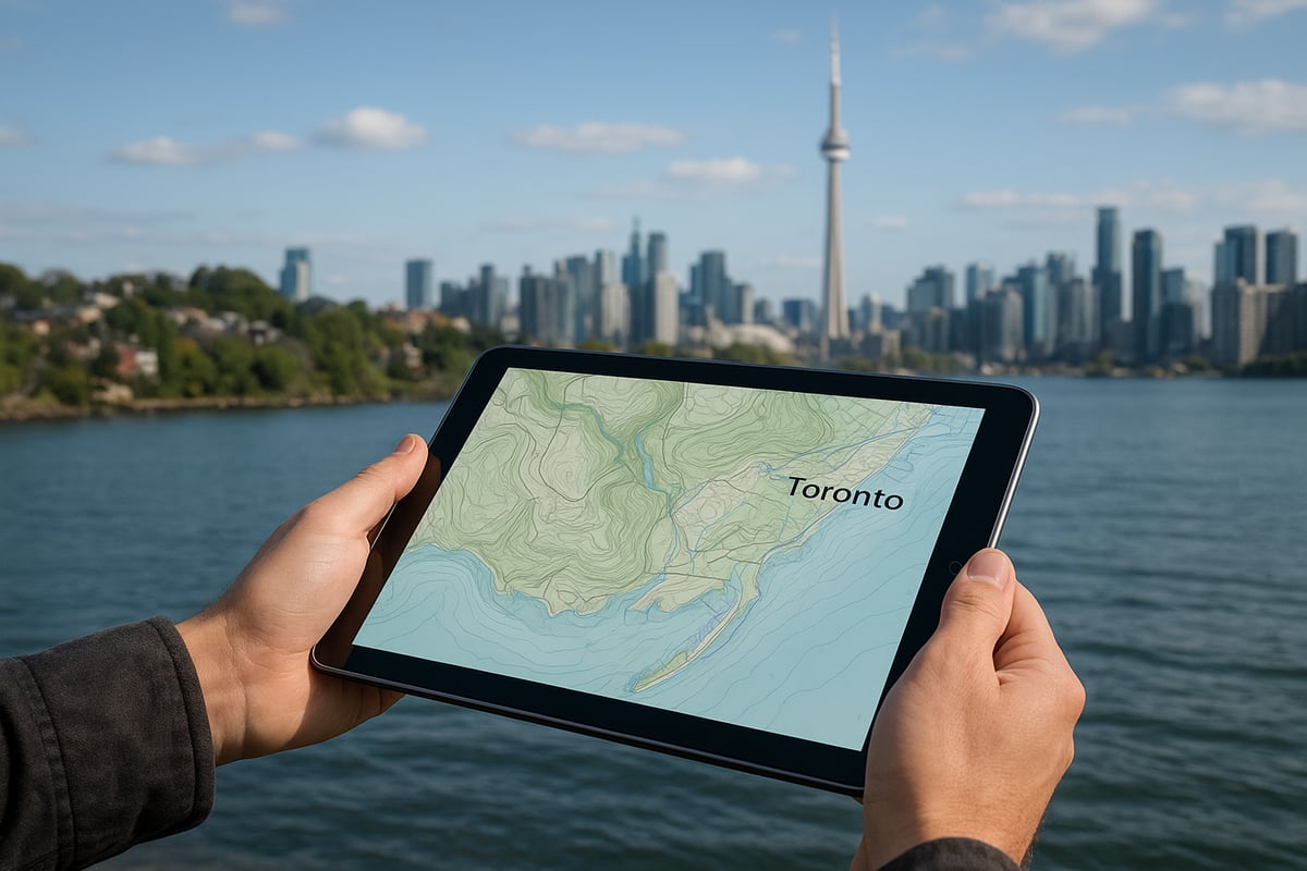
Curious about how to measure toronto elevation right where you live or work? Whether you are a homeowner, planner, or outdoor enthusiast, there are plenty of tools and resources that put this important info right at your fingertips. Let’s break down the best options, from quick digital checks to professional surveys.
Digital Maps and Apps
When it comes to checking toronto elevation, digital maps and apps make it easy. Google Earth is a favorite for many. You can zoom in on your neighborhood, click any spot, and instantly see the elevation in meters above sea level. Topographic maps, available online, let you see elevation lines that show how steep or flat an area is.
City of Toronto GIS tools are another great option. They provide detailed, interactive maps that let you search by address or zoom in on parks, valleys, and bluffs. If you are not sure how to get started, here’s a quick step-by-step guide:
- Open Google Earth or the City’s GIS map
- Enter your address or drop a pin
- Read the elevation data shown on screen
Try comparing different neighborhoods. You will notice how toronto elevation changes from the waterfront up to the city’s northern edge.
Government and Academic Resources
Official data is key when you need the most reliable toronto elevation information. The City of Toronto’s Open Data Portal is packed with datasets, including floodplain maps and elevation layers you can download or explore online. These are perfect for planning projects or checking if your property is near a risk area.
If you want even more precision, the University of Toronto’s urban geography researchers offer detailed elevation models. For advanced users, the High-Resolution Digital Elevation Model provides granular data for the entire city. This is especially helpful for urban planners or anyone needing the most up-to-date terrain info.
Academic and government tools let you create custom maps, analyze trends, and even predict future changes in toronto elevation.
DIY Elevation Measurement
Want to check toronto elevation when you are out and about? You do not need fancy equipment. Most smartphones have built-in GPS sensors that can estimate elevation. There are free apps like My Altitude or Altimeter GPS that use your phone’s location to give you a real-time reading.
Handheld GPS devices are another option, offering more accuracy for hiking or fieldwork. Just keep in mind, consumer devices can have errors of several meters. For best results:
- Calibrate your device before use
- Compare readings from different apps
- Use official maps for confirmation
Remember, exploring toronto elevation on your own can be fun and educational, but always double-check if precision matters.
When to Consult a Professional
Sometimes, a rough estimate will not do. If you are building a home, landscaping, or dealing with flood risk, a professional elevation survey is essential. Licensed surveyors and geotechnical engineers use advanced tools to map toronto elevation with pinpoint accuracy.
Scenarios where you might need a pro:
| Scenario | Why Consult a Pro? |
|---|---|
| Construction projects | Required for permits and safety |
| Floodplain assessment | Accurate risk analysis |
| Major landscaping | Ensures proper drainage |
| Legal disputes | Provides official documentation |
Look for surveyors with experience in Toronto’s unique terrain. For example, a recent development in North York relied on a detailed elevation survey to design effective drainage and avoid future flooding. If you ever have doubts about toronto elevation accuracy, a professional can give you peace of mind.
Future Trends: Elevation, Urban Growth, and Climate Change in Toronto
Toronto is changing fast, and the topic of toronto elevation is front and center as the city adapts to new realities. As you look toward the future, elevation will shape how neighborhoods grow, how climate challenges are met, and how residents stay safe and informed.
Urban Expansion and Elevation Challenges
Toronto is expanding into areas with both higher and lower elevations, creating unique challenges. Some new developments are popping up north of Steeles Avenue, where the terrain rises, while others are being built closer to the lake, in riskier low-lying spots.
With this urban push, city planners are updating zoning laws and building codes to address elevation-related risks, like flooding and soil erosion. For instance, in 2025, Toronto introduced stricter floodplain development restrictions for neighborhoods near river valleys and the waterfront. This means properties in these zones face tougher scrutiny before new homes or businesses can be built.
If you're interested in how these changes impact business and infrastructure, check out Toronto business and urban development for insights on evolving regulations and city planning. As the city grows, toronto elevation will influence not just where people live but how communities are designed for safety and sustainability.
Climate Change and Elevation-Related Risks
Climate change is making toronto elevation even more critical in planning for the future. By 2050, experts predict a rise in severe flooding and storm events, especially in neighborhoods closest to Lake Ontario and the Don Valley.
Rising lake levels are already putting pressure on low-lying areas, leading to an increased risk of basement flooding and infrastructure damage. The city is responding with new climate resilience initiatives, including better stormwater management systems and updated emergency response plans.
A quick look at Environment Canada’s data shows that neighborhoods at lower toronto elevation face higher risks during heavy rainfall events. These trends highlight why it’s important for residents, developers, and planners to stay aware of elevation data and its implications for daily life.
Technology and Innovation
Technology is revolutionizing the way we understand toronto elevation. Advances in remote sensing, LiDAR, and 3D mapping are giving city officials and residents access to detailed data on terrain and flood risk. These tools help predict which areas might be at risk during extreme weather, allowing for smarter planning and quicker response times.
If you want to explore toronto elevation data for yourself, the Elevation API by Natural Resources Canada is a valuable resource. With this tool, you can retrieve elevation information for any location in the city, supporting both personal projects and larger urban planning efforts.
Toronto is also piloting smart city applications, like real-time flood alerts and predictive modeling, to help keep communities safe. These innovations reflect the city's commitment to staying ahead of elevation-related challenges.
Community Awareness and Education
As toronto elevation becomes a bigger topic in city planning and climate adaptation, public awareness is more important than ever. The city is rolling out outreach campaigns to help residents understand how elevation affects emergency preparedness, property risk, and even recreational choices.
Schools and local organizations are teaching urban geography and environmental science, using toronto elevation as a real-world example. Community workshops and online resources make it easier for everyone to learn how elevation impacts their neighborhood.
Staying informed about toronto elevation means you can make smarter decisions about where to live, how to prepare for storms, and how to get involved in making the city safer for everyone.
Frequently Asked Questions About Toronto’s Elevation
Curious about toronto elevation? You’re not alone. Here are answers to the most common questions people have about the city’s unique topography and what it means for daily life.
What is the average elevation of Toronto?
The average toronto elevation sits at about 76 meters, or roughly 250 feet, above sea level. This average can vary depending on where you are in the city, especially as you move away from the lakeshore.
Which Toronto neighborhood is at the highest elevation?
If you’re looking for the city’s highest points, head north. Areas near Steeles Avenue and the city’s northern boundary reach up to 200 meters. The Scarborough Bluffs are also a well-known natural high point, rising nearly 90 meters above Lake Ontario.
How does toronto elevation affect flooding risk in the city?
Neighborhoods closer to lake level, like the waterfront and parts of downtown, are most at risk for flooding. Higher elevation areas, such as Forest Hill and Midtown, generally see fewer flood events. The city uses detailed elevation maps to plan drainage and stormwater systems.
Are there health benefits to living at higher elevations in Toronto?
While toronto elevation differences are not as dramatic as in mountain cities, some people notice fresher air and fewer allergy triggers at higher points, especially away from busy roads and industrial zones. However, the health impact is usually subtle within city limits.
How can I find out the elevation of my home or workplace?
You have several easy options:
- Use Google Earth or a topographic map to search your address.
- Check the City of Toronto’s GIS mapping tools for official data.
- Try a GPS-enabled smartphone app for a quick readout.
Does toronto elevation impact real estate prices in the city?
Absolutely. Homes with higher toronto elevation, especially those offering city or lake views, often command a premium. In contrast, properties in low-lying or flood-prone zones may see lower prices or higher insurance costs.
What should I consider about elevation when buying property in Toronto?
Keep these points in mind:
- Ask about past flooding or water issues.
- Consider the property’s slope, drainage, and proximity to rivers.
- Check if extra insurance or flood-proofing is needed for lower elevations.
Where can I find official elevation maps and resources for Toronto?
You’ll find the most accurate toronto elevation resources on the City of Toronto Open Data Portal. For a fun exploration of the city’s elevation landmarks, check out some of the Toronto tourist attractions and landmarks that highlight unique natural features like the Bluffs and river valleys.
Here’s a quick comparison table for reference:
| Location | Approximate Elevation (meters) |
|---|---|
| Waterfront | 75 |
| Downtown Core | 75-85 |
| Midtown (Forest Hill) | 130-150 |
| Scarborough Bluffs | Up to 90 above lake |
| North York (Steeles) | Up to 200 |
Whether you’re planning a move, investing, or just curious, understanding toronto elevation helps you make informed choices about where and how you live.
So, now that you’ve got the inside scoop on Toronto’s unique elevation—from the valleys and bluffs to how it shapes our weather and neighborhoods—you’re probably seeing the city in a whole new way. Exploring Toronto’s highs and lows is hungry work, right? If you’re curious about where to eat next (maybe in that neighborhood you just learned about), why not treat yourself to some of the best food our city has to offer? You can dive into hidden gems and local favourites all across town by checking out the Read The Complete Toronto Foodie Guide. Your next delicious adventure might be just around the corner!