Non-essential travel Friday evening is discouraged
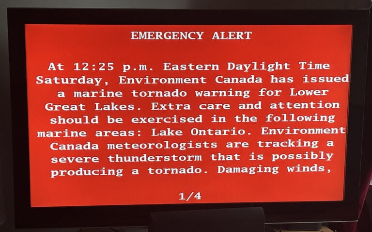
TORONTO, Mar. 3, 2023 – We’ve been hearing for days that the GTA is going to be hit by a severe winter storm with blizzard-like conditions, but now it is here! Environment and Climate Change Canada says a large portion of southern Ontario can expect snow at times heavy and blowing snow with accumulations of 20 – 30 cm starting early this evening and ending Saturday morning.
With this storm Friday into Saturday morning, Toronto could see snowfall rates of 5 to 8 cm/h, according to ECCC, Canada’s most trusted weather source. The most dangerous travel conditions are expected between about 9 P.M. and midnight when snowfall rates may be at their peak.
ECCC warns that with this significant winter storm with dangerous travel conditions expected tonight. Non-essential travel strongly discouraged.
Rapidly accumulating snowfall creating hazardous travel conditions.
Isolated power outages due to combination of heavy wet snow and wind.
Thunderstorm possible – known as Thundersnow
In addition to heavy snow there is a risk of a thunderstorm this evening. Often referred to as Thundersnow, (and also known as a winter thunderstorm or a thundersnowstorm) this is a kind of thunderstorm that happens with snow falling as the primary precipitation instead of rain.
As mentioned, the snowfall Amount expected in the GTA is 20 to 30 cm. Wind east 40 km/h gusting to 70 becoming northeast 20 gusting to 40 after midnight. Low minus 1. The snow is expected to be ending late in the morning on Saturday, then clearing. Wind north 30 km/h gusting to 50 becoming light late in the afternoon. High plus 4. UV index 4 or moderate. Increasing cloudiness late in the evening. on Saturday with a Low of minus 1.
With the snow, heavy at times, in combination with strong easterly winds will create significantly reduced visibility and hazardous travel conditions.
Residents are warned that surfaces such as highways, roads, walkways and parking lots may become difficult to navigate due to accumulating snow. Prepare for quickly changing and deteriorating travel conditions. Visibility will be suddenly reduced to near zero at times in heavy snow and blowing snow.
Please continue to monitor alerts and forecasts issued by Environment Canada. To report severe weather, send an email to ONstorm@ec.gc.ca or tweet reports using #ONStorm.
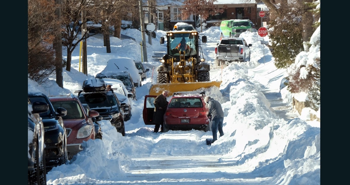
photo by Stephen Uhraney
SOURCE Environment and Climate Change Canada
Other articles from totimes.ca – otttimes.ca – mtltimes.ca