
TORONTO, January 25, 2024 – Yesterday marked the opening of two new roads and bridges that will link the future Villiers Island to downtown Toronto, as well as the surrounding Port Lands.
Part of a family of four iconic bridges, the Cherry Street North and Commissioners Street bridges are the latest connections to open in the Port Lands, marking a key advancement in the Port Lands Flood Protection project. The Cherry South Bridge, which crosses the future renaturalized mouth of the Don River, opened in October 2022.
“These new connections are an important step towards building a healthy and sustainable future community in the Port Lands, with new housing and public green space,” said Olivia Chow, Mayor of Toronto. “With dedicated cycling, walking and transit lanes on these roads and bridges, visitors and residents can access scenic parks and playgrounds that soothe the mind and nurture the soul. This achievement – and future revitalization on the waterfront – has happened because all levels of government have worked together,” said Mayor Olivia Chow.
Through an ongoing partnership, the new roads and bridges were made possible by investments from the Government of Canada, the Province of Ontario, and the City of Toronto in the Port Lands Flood Protection and Enabling Infrastructure Project. This project will provide critical flood protection to southeastern portions of downtown Toronto, transform the area into usable public and green space, and will upgrade critical infrastructure including roads and bridges. Additionally, these upgrades will connect people cycling, walking and driving to the future Villiers Island, and include space allocated to future transit.
About the New Bridges
- Four new bridges are being delivered as part of Port Lands Flood protection.
- The bridges were designed and engineered by Entuitive, Grimshaw and Schlaich Bergermann.
- After an open procurement process, Halifax-based Cherubini Metal Works won the contract to
fabricate the bridges. Some specialized work was also done in the Netherlands by a firm called
CGI Specifically, 3D bending of steel plates, which is something only a limited number of firms
do. - The steel is Canadian with the exception of the 3D shell components.
Commissioners Street Bridge - This bridge is orange and white – the longest of the new bridges, it has two arches.
- The western half of the bridge weighs 650 tonnes and measures 83 metres long.
- The eastern half of the bridge weighs 560 tonnes and measures 69 metres long.

Cherry Street North Bridges
- This location has two bridges. The wider bridge will carry vehicles, pedestrians, and cyclists. The
narrow bridge is dedicated to transit - The transit bridge weighs 340 tonnes and measures 57 metres long.
- The vehicular bridge is also 57 metres long and weighs 450 tonnes.
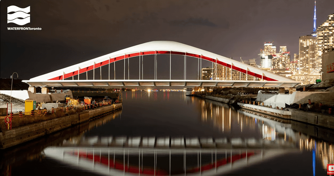
- Both bridges are red and white.
- The Cherry Street North transit bridge was the first to arrive in Toronto.
“These bridges reflect the innovation and design excellence woven through all of Waterfront Toronto’s projects. These connections fulfil a promise to reconnect people to the waterfront and to reorient Toronto to the lake by turning underused, post-industrial lands into the city’s new front porch. People crossing these bridges will get their first look at the new parks and river that are under construction. For many, it will be the first time they encounter the potential of Villiers Island to create new access to water, sprawling greenspace and new housing right downtown.”
George Zegarac, President and CEO, Waterfront Toronto

About The Port Lands
The Port Lands, bounded by the Keating Channel/Don River and Lake Shore Boulevard in the north, the
Toronto Inner Harbour in the west, Ashbridges Bay in the east and Lake Ontario and Tommy Thompson
Park in the south, was created by decades of infilling what was once one of the largest wetlands on Lake
Ontario. Beginning in the late 1800s, the area was gradually filled in to make more land available for
industry and shipping. As the natural mouth of the Don River was filled in, the Keating Channel was
created to provide an outlet for the Don River watershed into Lake Ontario and a means to convey
storm water.
A designated flood plain
Today, the Port Lands area sits within a designated floodplain, which is an area anticipated to
experience flooding in the event of a regional storm or the 100-year flood – whichever is greater.
Providing flood protection for the Port Lands was identified as a top priority by all three orders of
government when they first established Waterfront Toronto in 2001.
In the last decade, governments across the country have had to contend with weather events that are
occurring with more frequency and severity. In particular, floods are happening more often in urban
areas and the financial risk to governments to pay for the damages is also increasing.
Flood Risk
Currently, about 290 hectares (715 acres) of southeastern downtown Toronto, including parts of the
Port Lands, South Riverdale, Leslieville, south of Eastern Avenue and the East Harbour development site,
are at risk of flooding from the Don River watershed and cannot be revitalized until they are flood
protected.
About Port Lands Flood Protection
Port Lands Flood Protection is a comprehensive solution to flood risk that also addresses the
fundamental challenge of transforming the underused and post-industrial Port Lands into a long-term
asset that will support Toronto’s growth and economic competitiveness.
This is one of the largest infrastructure projects underway in Canada, funded by three levels of
government. This eight-year construction project is well underway, due to be complete by the end of
2024.
When complete, Port Lands flood protection will:
- Improve Toronto’s climate resiliency and enable development of much-needed housing
- Provide over 70 acres hectares of new parks and greenspace, including 30 acres of new coastal
wetland and 10 acres of terrestrial habitat, and 1,000 meters of new river channel and flood
plain - Provide new transportation infrastructure including four new bridges, expanded and improved
pedestrian and cycling facilities throughout the project area - Provide an improved public realm, conserved and interpreted heritage features, and new
features that reflect the area’s significance to Indigenous communities - Flood protect almost 600 acres of land around the mouth of the Don River and unlock the
development – and value – of lands located within the existing flood plain.
Other articles from totimes.ca – otttimes.ca – mtltimes.ca


You must be logged in to post a comment.