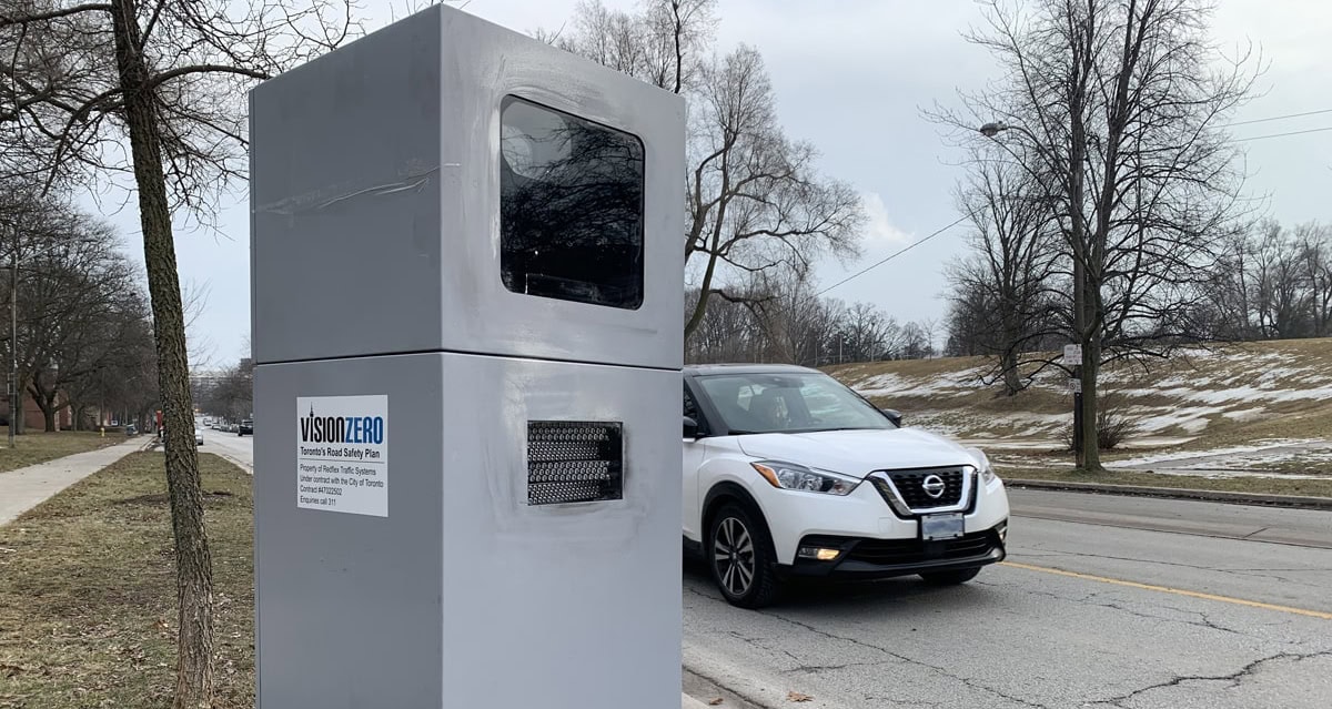
The City of Toronto’s 50 Automated Speed Enforcement (ASE) devices issued a total of 21,242 tickets in September, the fourth month of enforcement at the third round of locations near schools in Community Safety Zones.
Between September 1 and September 30, the device on Victoria Park Avenue, near Tiago Avenue, issued the most tickets at 2,664, or 13 per cent of all tickets. According to the data, there were 926 repeat offenders in September with the two most frequent repeat offenders each receiving five tickets for speeding on Bamburgh Circle and Military Trail in Scarborough.
The uptick in the number of tickets issued in September when compared to July and August is likely due to traffic volumes increasing city-wide as students returned to in-class learning.
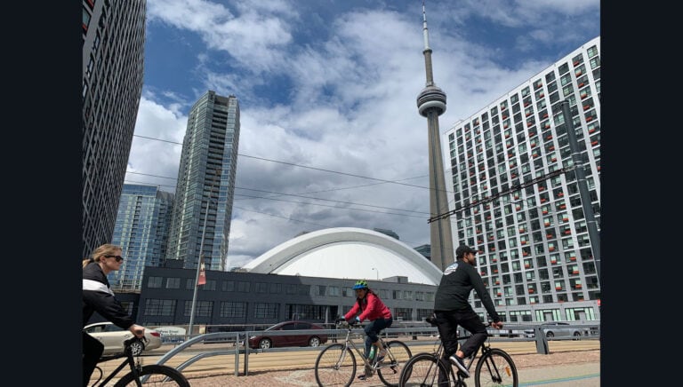
“The Automated Speed Enforcement program continues to promote safe driving by reducing speeds near schools in Community Safety Zones,” said – Mayor John Tory. “This program, coupled with the many Vision Zero initiatives we are deploying across the city, is an essential speed management measure that we are using to ensure our streets are safer for everyone, especially for schoolchildren, older adults, pedestrians and cyclists,” added Tory.
The devices issued a total of 18,619 tickets in July and 18,114 tickets in August, the second and third months of enforcement at the third round of camera locations. The full enforcement data for July and August is available here.
All ASE devices have now rotated to the fourth round of locations to help reduce speeding at more areas with safety concerns, encourage a wide-ranging deterrent effect and raise public awareness about the need to slow down and obey posted speed limits. Signs have been posted at all locations to warn drivers in advance.
The current ASE locations are:
- Kipling Avenue south of Snaresbrook Drive (Etobicoke North)
- Silverstone Drive north of Avening Drive (Etobicoke North)
- The Westway west of Brampton Road (Etobicoke Centre)
- Montgomery Road near Loyalist Road (Etobicoke Centre)
- Birmingham Street west of Kipling Avenue (Etobicoke-Lakeshore)
- Royal York Road north of Coney Road (Etobicoke-Lakeshore)
- Priscilla Avenue south of Dundas Street West (Parkdale-High Park)
- Jane Street south of Weatherell Street (Parkdale-High Park)
- Lawrence Avenue West east of Martini Drive (York South-Weston)
- King Street south of George Street (York South-Weston)
- Sheppard Avenue West east of Buckland Road (York Centre)
- Faywood Boulevard near Norcross Road (York Centre)
- Jane Street north of Clair Road (Humber River-Black Creek)
- Yorkwoods Gate east of Jane Street (Humber River-Black Creek)
- Glenmount Avenue near Madoc Drive (Eglinton-Lawrence)
- Avenue Road south of Caribou Road (Eglinton-Lawrence)
- Dufferin Street north of Norton Avenue (Davenport)
- Oakwood Avenue near Biggar Avenue (Davenport)
- Queens Quay West east of Bathurst Street (Spadina-Fort York)
- Givins Street south of Argyle Street (Spadina-Fort York)
- Davenport Road near Bishop Street (University-Rosedale)
- Beverley Street near D’Arcy Street (University-Rosedale)
- Bathurst Street near Ardmore Road (Toronto-St. Paul’s)
- Arlington Avenue south of Durham Avenue (Toronto-St. Paul’s)
- Queen Street East near Sackville Street (Toronto Centre)
- Isabella Street west of Sherbourne Street (Toronto Centre)
- Donlands Avenue near Memorial Park Avenue (Toronto-Danforth)
- Westwood Avenue west of Carlaw Avenue (Toronto-Danforth)
- Lawrence Avenue East east of Mildenhall Road (Don Valley West)
- Banbury Road near Portsmith Road (Don Valley West)
- Scarsdale Road south of York Mills Road (Don Valley East)
- Wallingford Road north of Cassandra Boulevard (Don Valley East)
- Victoria Park Avenue north of Old Sheppard Avenue (Don Valley North)
- Brian Drive north of Clydesdale Drive (Don Valley North)
- Senlac Road south of Horsham Avenue (Willowdale)
- Cactus Avenue north of Moore Park Avenue (Willowdale)
- O’Connor Drive near Wakunda Place (Beaches-East York)
- Cosburn Avenue west of Binswood Avenue (Beaches-East York)
- Kingston Road east of Chine Drive (Scarborough Southwest)
- Cathedral Bluffs Drive south of Kingston Road (Scarborough Southwest)
- Birchmount Road south of Ellendale Drive (Scarborough Centre)
- Dewey Drive east of Pharmacy Avenue (Scarborough Centre)
- Warden Avenue south of Glen Springs Drive (Scarborough-Agincourt)
- Lockie Avenue east of Donalda Crescent (Scarborough-Agincourt)
- Finch Avenue East west of Neilson Road (Scarborough North)
- Nugget Avenue east of Transfer Place (Scarborough North)
- Bellamy Road North south of Northleigh Drive (Scarborough-Guildwood)
- Brimorton Drive near Amberjack Boulevard (Scarborough-Guildwood)
- Manse Road near 292 Manse Rd. (Scarborough-Rouge Park)
- Wickson Trail west of Brenyon Way (Scarborough-Rouge Park)
The total payable fine amount includes a set fine, which is determined by Schedule D under the Provincial Offences Act, a victim fine surcharge and applicable court costs. ASE tickets do not incur any demerit points and do not affect a person’s driving record.
The City continues to retroactively process Part III offences for excessive speeding incidents captured by the ASE devices following delays caused by the COVID-19 pandemic. Excessive speeding is when a vehicle has exceeded the speed limit by 50 km/h or more. Under provincial regulations, there is no set fine for charges related to excessive speeding. Instead, a summons will be served to the registered vehicle owner to appear before a Justice of the Peace.
To date, 197 Part III charges have been laid since the start of enforcement on July 6, 2020. The highest excessive speed detected was 141 km/h in a 50 km/h speed limit zone on Martin Grove Road, north of Garfella Drive. The device at this location also captured 33 Part III offenders, the highest since enforcement began.
The 50 ASE devices are installed near schools in Community Safety Zones. Sites are selected primarily based on data that indicate where speed and collision challenges exist. Each ward has two ASE devices that capture and record images of vehicles travelling in excess of the posted speed limit.
The ASE program aims to increase road safety, reduce speeding and raise public awareness about the need to slow down and obey posted speed limits. It is designed to work in tandem with other Vision Zero methods and strategies, including engineering measures, education initiatives and traditional police enforcement.
More information about the program, how to pay fees and a map of all current and planned locations are available online .
Other articles from totimes.ca – otttimes.ca – mtltimes.ca