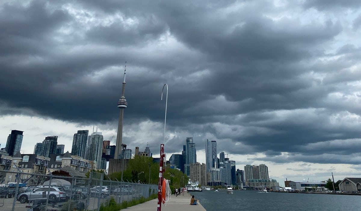
TORONTO, June 27, 2023 – At 10:03 am today Environment and Climate Change Canada issued a Special Weather Statement warning of localized heavy rainfall as well as funnel cloud potential across southern Ontario.
ECCC says the GTA and most of south and central Ontario can expect slow-moving showers or thunderstorms today across the region and some areas may receive significant rainfall amounts and that “conditions will be favourable for the development of funnel clouds today.”
Funnel Clouds possible today
The types of funnel clouds expected are generated by weak rotation under rapidly growing clouds or weak thunderstorms, according to ECCC. This weak rotation is normally not a danger near the ground. However, there is a chance that this rotation could intensify and become a weak landspout tornado.
Landspout Tornadoes
Landspout tornadoes do not usually cause significant damage but can still be dangerous,” according to ECCC. They can be strong enough to topple trees, damage roofs or toss debris short distances.
Heavy Downpours
Heavy downpours can cause flash floods and water pooling on roads. If visibility is reduced while driving, slow down, watch for tail lights ahead and be prepared to stop. Localized flooding in low-lying areas is possible. Heavy rainfall in combination with other weather factors, such as hail, wind and lightning will make outdoor activities unsafe.
Special Weather Statement Issued for the following areas:
- Angus
- Apsley
- Arnprior
- Balsam Lake Park
- Bancroft
- Bannockburn
- Barrie
- Barry’s Bay
- Beaverton
- Bon Echo Park
- Brampton
- Burlington
- Calabogie
- Caledon
- Caledonia
- City Of Hamilton
- City Of Toronto
- Cobden
- Coldwater
- Collingwood
- Deep River
- Denbigh
- Dunnville
- Eastern Algonquin Park
- Fenelon Falls
- Fort Irwin
- Georgina
- Grimsby
- Haldimand
- Haliburton
- Halton Hills
- Hastings Highlands
- Hillsdale
- Innisfil
- Kaladar
- Killaloe
- Lagoon City
- Lake of Two Rivers
- Lakefield
- Lindsay
- Markham
- Midland
- Milton
- Minden
- Mississauga
- New Tecumseth
- Newmarket
- Niagara Falls
- Northern Durham Region
- Northern Haliburton County
- Northern Kawartha Lakes
- Northern Niagara Region
- Northern Peterborough County
- Northern York Region
- Oakville
- Orillia
- Orr Lake
- Oshawa
- Oxtongue Lake
- Pembroke
- Petawawa
- Peterborough City
- Pickering
- Renfrew
- Richmond Hill
- Southern Durham Region
- Southern Haliburton County
- Southern Kawartha Lakes
- Southern Niagara Region
- Southern Peterborough County
- St. Catharines
- Uxbridge
- Vaughan
- Washago
- Welland
- Western Algonquin Park
- Whitney
- Woodview
For information concerning flooding, please consult your local Conservation Authority or Ontario Ministry of Natural Resources and Forestry office. Visit Ontario.ca/floods for the latest details.
Please continue to monitor alerts and forecasts issued by Environment Canada. To report severe weather, send an email to ONstorm@ec.gc.ca or tweet reports using #ONStorm.
Other articles from totimes.ca – otttimes.ca – mtltimes.ca